

Archiu:NZL orthographic NaturalEarth.svg
De L'Enciclopèdia, la wikipedia en valencià

Tamany d'esta previsualisació PNG de l'archiu SVG: 512 × 512 píxels. Atres/s resolucions: 240 × 240 píxels | 480 × 480 píxels | 768 × 768 píxels | 1024 × 1024 píxels | 2048 × 2048 píxels.
Resolució completa. ((Image SVG, nominalment 512 × 512 pixels, tamany d'archiu: 574 kB))
Este archiu és de Wikimedia Commons i pot usar-se en atres proyectes. La descripció en la seua pàgina de descripció de l'archiu se mostra baix.
Summary
| DescriptionNZL orthographic NaturalEarth.svg |
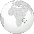
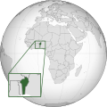
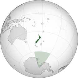
English: A map of the hemisphere centred on Wellington, New Zealand, using an orthographic projection, created using gringer's Perl script with Natural Earth Data (1:50000 resolution, simplified to 0.25px). New Zealand is highlighted in green. |
| Date | |
| Source | Own work |
| Author | Gringer |
| Other versions |
Derivative works of this file: Novozelandske kralovstvi.jpg |
| SVG InfoField |
.svg)
العربية: الرجاء، قراءة الميثاق.
বাংলা: দয়া করে, রীতিনীতিটি পড়ুন।
Deutsch: Bitte lies die Konventionen.
English: Please, read the conventions.
Español: Por favor, lea las convenciones.
Filipino: Paki-basa ang mga kumbensyon.
Français : S'il vous plaît, lisez les conventions.
हिन्दी: कृपया सभागमों को पढ़ लें.
Bahasa Indonesia: Silakan, baca konvensi.
Italiano: Si prega di leggere le convenzioni.
日本語: 規約をご確認ください。
ქართული: გთხოვთ, გაეცნოთ კონვენციებს.
Македонски: Ве молиме, прочитајте ги општоприфатените правила.
Português: Por favor, leia as convenções.
Русский: Пожалуйста, прочитайте соглашения.
Tagalog: Paki-basa ang mga kumbensyon.
Українська: Будь ласка, прочитайте конвенції.
Tiếng Việt: Hãy đọc công văn trước khi đăng.
中文(繁體):請檢視常規
中文(简体):请查看常规
World maps
-
 Africa
 -
 Burundi
 -
 Comoros
 -
 Djibouti
 -
 Eritrea
 -
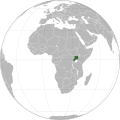
 Ethiopia
 -
 Kenya
Kenya -
 Madagascar
 -
 Malawi
 -
 Mauritius
 -
 Mayotte
 -
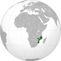 Mozambique
 -
 Tanzania
 -
 Somalia
 -
 Uganda
 -
 Lesotho
 -
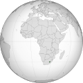
 South Africa
 -
 Zambia
 -
 Zimbabwe
 -
 Angola
 -
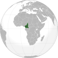 Cameroon
 -
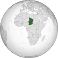
 Central African Republic
 -
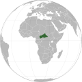
 Chad
Chad -
 Republic of the Congo
 -
 Democratic Republic of the Congo
 -
 Gabon
Gabon -
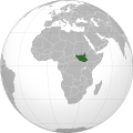 South Sudan
 -
 Algeria
 -
 Egypt
Egypt -
 Libya
Libya -
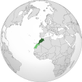 Morocco
 -
 Morocco & Western Sahara
 -
 Sahrawri Arab Democratic Republic
 -
 Sudan
Sudan -
 Tunisia
 -
 Western Sahara
 -
 Azawad
 -
 Benin
Benin -
 Burkina Faso
 -
 Cape Verde
 -
 Côte d'Ivoire
 -
 Gambia
 -
 Ghana
Ghana -
 Guinea
 -
 Liberia
 -
 Mali
Mali -
 Mali without Azawad
 -
 Mauritania
 -
 Niger
Niger -
 Nigeria
 -
 Senegal
 -
 Sierra Leone
 -
 Greenland
 -
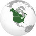
 Canada
 -
 United States of America
 -
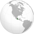
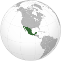
 Mexico
 -
 Guatemala
 -
 El Salvador
 -
 Honduras
 -
 Nicaragua
 -
 Costa Rica
 -
 Panama
 -
 Trinidad and Tobago
 -
 Cuba
Cuba -
 Dominican Republic
 -
 Haiti
Haiti -
 Jamaica
 -
 Argentina
 -
 Bolivia
 -
 Brazil
 -
 Chile
Chile -
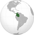
 Colombia
 -
 Ecuador
 -
 French Guiana
 -
 Guyana
 -
 Paraguay
 -
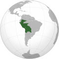
 Peru
Peru -
 Suriname
 -
 Uruguay
 -
 Venezuela (excluding claimed)
 -
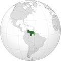 Venezuela (including claimed)
 -
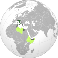
 "Asia (orthographic projection).svg", frequently subject to lame edit wars over the Caucasus boundary
 -
 East Asia
 -
 China
China -
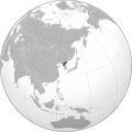
 Japan
Japan -
 Mongolia
 -
 North Korea (excluding claimed)
 -
 South Korea (excluding claimed)
 -
 Jiangxi
 -
 Taiwan
 -
 Republic of China (including claimed)
 -
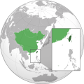 Republic of China (enlargement of Taiwan)
 -
 Republic of Korea (including claimed)
 -
 Democratic People's Republic of Korea (including claimed)
 -
 Korea
Korea -
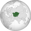 Central Asia
 -
 Kazakhstan
 -
 Tajikistan
 -
 Kyrgyzstan
 -
 Uzbekistan
 -
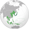
 Southeast Asia
 -
 Association of Southeast Asian Nations
 -
 The Philippines and ASEAN
 -
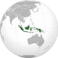 Indonesia
 -
 Malaysia
 -
 Philippines
 -
 Thailand
 -
 South Asia
 -
 Afghanistan
 -
 Bangladesh
 -
 Bhutan
 -
 India
India -
 Maldives
 -
 Nepal
Nepal -
 Pakistan
 -
 Sri Lanka
 -
 Western Asia
 -
 Levant
 -
 Georgia
 -
 Georgia (with inset), showing breakaway states
 -
 Georgia (with inset), without breakaway states
 -
 Armenia
 -
 Azerbaijan
 -
 Nagorno-Karabakh Republic
 -
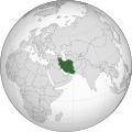 Iran
Iran -
 Iraq
Iraq -
 Israel
 -
 Jordan
 -
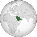 Saudi Arabia
 -
 State of Palestine
 -
 Syria
Syria -
 Lebanon
 -
 Turkey
 -
 United Arab Emirates
 -
 Europe, Caucasus-Urals boundary
 -
 Europe, unclear boundary somewhere in the mid-Caucasus, suffering from edit-wars
 -
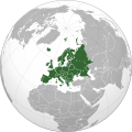 Europe, Caucasus-Urals boundary, with state borders
 -
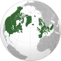
 Northern Europe
 -
 Southern Europe
 -
 Western Europe
 -
 Northwestern Europe
 -
 Mainland Europe
 -
 Latin Europe
 -
 Council of Europe
 -
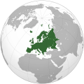
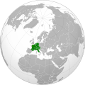
 European Union
 -
 European Union with internal borders
 -
 Benelux
 -
 Visegrád Group
 -
 British Isles
 -
 Great Britain
 -
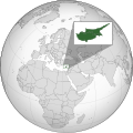 Island of Cyprus
 -
 Iberia
 -
 Albania
 -
Armenia
-
 Azerbaijan
 -
 Belarus
 -
 Belgium
 -
 Bosnia and Herzegovina
 -
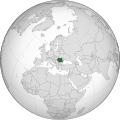
 Bulgaria
 -
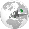
 Republic of Cyprus
 -
 Czech Republic
 -
 Denmark
 -
 Finland
 -
 France
 -
Georgia
-
Georgia (with inset), showing breakaway states
-
Georgia (with inset), without breakaway states
-
 Germany
 -
 Iceland
 -
 Italy
Italy -
Kazakhstan
-
 Kosovo
 -
 North Macedonia
 -
 Montenegro
 -
 Netherlands
 -
 Norway
 -
 Northern Cyprus
 -
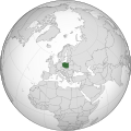 Poland
 -
 Portugal
 -
 Romania
 -
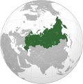 Russia
 -
 Serbia
 -
 Spain
Spain -
 Sweden
 -
 Switzerland
 -
Turkey
-
 United Kingdom
 -
 Oceania
 -
 Australia-New Guinea
 -
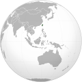
 Australia
 -
 Fiji
Fiji -
 New Zealand
 -
 Papua New Guinea
 -
 The Americas
 -
 Afro-eurasia
 -
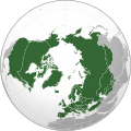
 Arctic
 -
 Antarctica
 -
 Kingdom of the Netherlands
 -
 Organization for Security and Co-operation in Europe
 -
 Eurasia
 -
 Eurasian Economic Union
 -
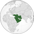
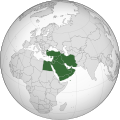
 Greater Middle East
 -
 Ibero-America
 -
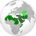
 Middle East
 -
 North Atlantic Treaty Organization
 -
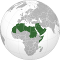 Arab World
 -
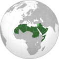 Arab League
 -
 Latin America
 -
 Anglo America
 -
 Franco America
 -
 Hispanic America
 -
 Shanghai Cooperation Organization
 -
 Almoravid Empire
 -
 Austro-Hungary
 -
 Aztec Empire
 -
 Aztec Empire (with dominance between Teozapotlan and Xoconochco)
 -
 Biafra
 -
 Benin (Separatist state in Nigeria)
 -
 Captaincy General of Chile
 -
 Chincha Country
 -
 Confederate States of America
 -
 Dominion of Pakistan (with Indian Controlled Kashmir)
 -
 Eurasian Economic Community
 -
 European Economic Community
 -
 Empire of Brazil
 -
 Federal Republic of Central America
 -
 First Mexican Empire
 -
 Frankish Empire
 -
 German Reich
 -
 German Reich (With Occupations)
 -
 Great Colombia
 -
 Granadine Confederation
 -
 Italian Empire
 -
 Japanese Empire
 -
 Inca Empire
 -
 Mughal Empire
 -
 New France
 -
 New Granada
 -
 Peru–Bolivia Confederation
 -
 Roman Empire
 -
 Russian Empire
 -
 Second Mexican Empire
 -
 Songhai Empire
 -
 Union of Soviet Socialist Republics
 -
 United Arab Republic
 -
 United Provinces of Central America
 -
 United States of Colombia
 -
 Viceroyalty of New Granada
 -
 Viceroyalty of New Spain
 -
 Viceroyalty of Peru
 -
 Viceroyalty of the Río de la Plata
 -
 Wilsonian Armenia
 -
 Canary Islands, Spain
 -
 Catalan Countries
 -
French Guiana
-
Greenland
-
 Québec, Canada
 -
 Puerto Rico, U.S.
 -
Great Britain
-
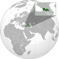
 Dagestan (Federal subject of Russia)
.svg)
.svg)
.svg)
.svg)
.svg)
.svg)
.svg)
.svg)
.svg)
.svg)
.svg)
.svg)
.svg)
.svg)
.svg)
.svg)
.svg)
.svg)
.svg)
.svg)
.svg)
.svg)
.svg)
.svg)
.svg)
.svg)
.svg)
.svg)
.svg)
.svg)
.svg)
.svg)
.svg)
.svg)
.svg)
.svg)
.svg)
.svg)
.svg)
.svg)
.svg)
.svg)
.svg)
.svg)
.svg)
.svg)
.svg)
.svg)
.svg)
.svg)
.svg)
.svg)
.svg)
.svg)
.svg)
.svg)
.svg)

.svg)
.svg)
.svg)
.svg)
.svg)
.svg)
.svg)
.svg)
.svg)
.svg)
.svg)
.svg)
.svg)
.svg)
.svg)
.svg)
.svg)
.svg)
.svg)
.svg)
.svg)


.svg)
.svg)
.svg)
.svg)
.svg)
.svg)
.svg)

.svg)
.svg)
.svg)
.svg)
.svg)
.svg)
.svg)
.svg)
.svg)
.svg)

.svg)
.svg)
.svg)
.svg)
.svg)
.svg)
.svg)
_without_national_boundaries.svg)
.svg)
.svg)
.svg)
.svg)
.svg)
.svg)

.svg)
.svg)
.png)
.svg)
.svg)
.svg)
.svg)

.svg)
.svg)
.svg)
.svg)
.svg)
.svg)
.svg)
.svg)
.svg)
.svg)
.svg)

.svg)
.svg)
.svg)
.svg)
.svg)
.svg)
.svg)
.svg)
.svg)

.svg)
.svg)

.svg)
.svg)
.svg)
.svg)
.svg)
.svg)
.svg)
.svg)
.svg)
.svg)
.svg)
.svg)
.svg)
.svg)
.svg)
.svg)
.svg)
.svg)
.svg)
.svg)
.svg)
.svg)
.svg)
.svg)
.svg)
.svg)
.svg)
_-_Crimea_disputed.svg)
.svg)
.svg)
.svg)
.svg)
.svg)
.svg)
.svg)
.svg)
.svg)
.svg)
.svg)
.svg)
_political.svg)
.svg)
.svg)
.svg)
.svg)
_-_Crimea_disputed_-_no_borders.svg)
.svg)
.svg)
.svg)
.svg)
.svg)
.svg)
.svg)
.svg)
.svg)
.svg)
.svg)

.svg)
.svg)
.svg)

.png)
.svg)
.svg)
.svg)
.svg)
.svg)
.svg)
.svg)
.svg)
.svg)
.svg)
.svg)
.svg)
.svg)
.svg)
.svg)
.svg)
.svg)
.svg)
.svg)
.svg)
.svg)
.svg)
.svg)
.svg)
.svg)
.svg)
.svg)
.svg)
.svg)
.svg)
.svg)
.svg)
.svg)
.svg)
.png)
.svg)
.svg)
.svg)
_(orthographic_projection).png)
Licensing
| Public domainPublic domainfalsefalse |
| I, the copyright holder of this work, release this work into the public domain. This applies worldwide. In some countries this may not be legally possible; if so: I grant anyone the right to use this work for any purpose, without any conditions, unless such conditions are required by law. |
Kermadec Islands polygons, only: Contains data sourced from Land Information New Zealand under CC-By-3.0-NZ:
This file is licensed under the Creative Commons Attribution 3.0 New Zealand license.
- You are free:
- to share – to copy, distribute and transmit the work
- to remix – to adapt the work
- Under the following conditions:
- attribution – You must give appropriate credit, provide a link to the license, and indicate if changes were made. You may do so in any reasonable manner, but not in any way that suggests the licensor endorses you or your use.
Captions
Add a one-line explanation of what this file represents
New Zealand
Globe terrestre avec la Nouvelle-Zélande, ses îles et son territoire du Pôle Sud en vert.
Items portrayed in this file
depicts English
Pacific Ocean English
creator English
Some value without a Wikidata item
inception English
31 August 2010
source of file English
original creation by uploader English
media type English
image/svg+xml
Historial de l'image
Puncha en la data/hora per a vore l'image tal i com es mostrava en eixe moment.
| Data/Hora | Miniatura | Dimensions | Usuari | Descripció | |
|---|---|---|---|---|---|
| actual | 22:06 31 oct 2013 | | 512 × 512 (574 kB) | wikimediacommons>TooncesB | == Summary == {{Information |Description={{en|1=A map of the hemisphere centred on Wellington, New Zealand, using an orthographic projection, created using gringer's Perl script with [http://www.naturalear... |
Enllaços a l'image
Les següents pàgines enllacen ad esta image:
Metasenyes
Est archiu conté informació adicional, provablement afegida per la càmara digital o l'escàner usat per a crear-lo o digitalisar-lo. Si l'archiu ha segut modificat posteriorment, alguns detalls poden no correspondre en l'informació real de l'archiu.
| Amplària | 100% |
|---|---|
| Altura | 100% |