
Archiu:Arabian Peninsula dust SeaWiFS.jpg

Tamany d'esta vista prèvia: 657 × 600 píxels. Atres/s resolucions: 263 × 240 píxels | 526 × 480 píxels | 841 × 768 píxels | 1122 × 1024 píxels | 2504 × 2286 píxels.
Resolució completa. ((2504 × 2286 pixels, tamany de l'archiu: 853 kB, MIME tipo: image/jpeg))
| Description |
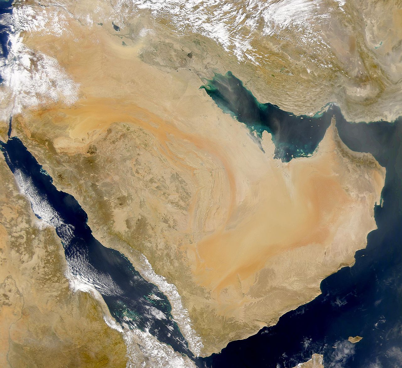
English: SeaWiFS collected this view of Arabia and of dust blowing across the Persian Gulf.
Español: La Península Arábiga vista desde el espacio |
| Date | Taken on 2 March 2000 |
| Source | http://visibleearth.nasa.gov/view_rec.php?id=898 |
| Author | SeaWiFS Project, NASA/Goddard Space Flight Center, and ORBIMAGE |
| Other versions |
Derivative works of this file: |
| This image is from the Sea-viewing Wide Field-of-view Sensor (SeaWiFS) Project and more than 5 years old.
Satellite data captured by the SeaWIFS sensor are released into the public domain 5 years after capture. Data less than five years old can be re-used only for educational or scientific purposes; any commercial use of such images must be coordinated with GeoEye. [1] |
| This work has been released into the public domain by its copyright holder, GeoEye. This applies worldwide. In some countries this may not be legally possible; if so: GeoEye grants anyone the right to use this work for any purpose, without any conditions, unless such conditions are required by law.
|
Original upload log
The original description page was here. All following user names refer to commons.wikimedia.
- 2007-12-17 19:34 Hautala 2,504×2,286 (853000 bytes) {{PD-USGov-NASA}} Taken from NASA's Visible Earth, http://visibleearth.nasa.gov/
Historial de l'image
Puncha en la data/hora per a vore l'image tal i com es mostrava en eixe moment.
| Data/Hora | Miniatura | Dimensions | Usuari | Descripció | |
|---|---|---|---|---|---|
| actual | 17:02 2 gin 2008 | | 2504 × 2286 (853 kB) | wikimediacommons>Hautala | {{PD-USGov-NASA}} * {{en|Satellite image of Arabian peninsula}} * {{es|La Península Arábiga vista desde el espacio}} * {{en|Satelliittikuva Arabian niemimaasta}} Taken from NASA's [http://visibleearth.nasa.gov/ Visible Earth], from the page [http://v |
Enllaços a l'image
Les següents pàgines enllacen ad esta image: