

Archiu:Maroc carte.gif
No es dispon d'una resolució més alta.
Maroc_carte.gif ((329 × 352 pixels, tamany de l'archiu: 21 kB, MIME tipo: image/gif))

|
This map image could be re-created using vector graphics as an SVG file. This has several advantages; see Commons:Media for cleanup for more information. If an SVG form of this image is available, please upload it and afterwards replace this template with
{{vector version available|new image name}}.It is recommended to name the SVG file “Maroc carte.svg”—then the template Vector version available (or Vva) does not need the new image name parameter. |
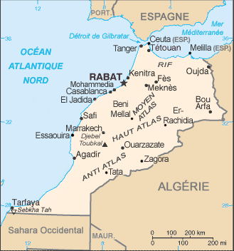
Summary
| Description | Carte du Maroc |
| Date | |
| Source | Wikipédia francophone |
| Author | l'Atelier graphique |
Licensing
| I, the copyright holder of this work, release this work into the public domain. This applies worldwide. In some countries this may not be legally possible; if so: I grant anyone the right to use this work for any purpose, without any conditions, unless such conditions are required by law. |
la carte du Maroc ( Almagreb) doit comporter toutes ses terres, le sahara orientale occupée par la france et après par l'algerie, le sahara du sud jusqu'à laguira les iles et ilots sur toutes les côtes méditerranéennes et atlantiques qui sont des terres Marocaines et le resterons.
Historial de l'image
Puncha en la data/hora per a vore l'image tal i com es mostrava en eixe moment.
| Data/Hora | Miniatura | Dimensions | Usuari | Descripció | |
|---|---|---|---|---|---|
| actual | 21:13 30 gin 2012 | | 329 × 352 (21 kB) | wikimediacommons>99of9 | Reverted to version as of 23:04, 2 February 2011 per COM:OVERWRITE |
Enllaços a l'image
No n'hi ha pàgines que enllaçen a esta image.