


Archiu:Rummu aherainemägi2.jpg
Tamany d'esta vista prèvia: 800 × 279 píxels. Atres/s resolucions: 320 × 112 píxels | 640 × 223 píxels | 1024 × 358 píxels | 1280 × 447 píxels | 2560 × 894 píxels | 8374 × 2924 píxels.
Resolució completa. ((8374 × 2924 pixels, tamany de l'archiu: 16,67 MB, MIME tipo: image/jpeg))
Summary
| Description |
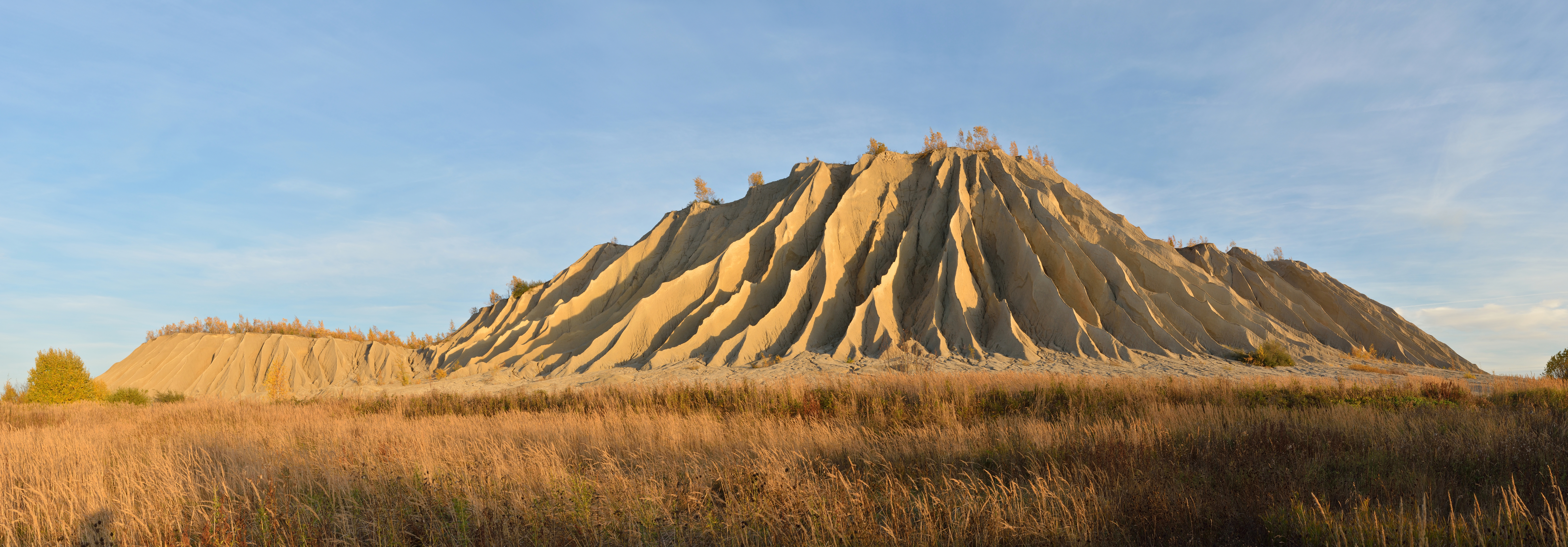
Eesti: Rummu aherainemägi. Vihmaerosiooni tagajärjel on mäeküljed vagulised. |
| Date | |
| Source | Own work |
| Author | Ivar Leidus |
| Camera location |   | View this and other nearby images on: OpenStreetMap |  |
|---|
| Camera model | Nikon D5200 |
|---|---|
| Shutter speed | 1/125; |
| Aperture | f/8; |
| ISO speed rating | 200; |
 This image was created with Hugin.
|


|
This image was selected as picture of the day on Wikimedia Commons for 26 April 2014. It was captioned as follows: English: Spoil tip in Rummu, Estonia. Hillside is covered with rills and gullies due to erosion processes caused by rainfall. Other languages:
Bosanski: Vrh odlagališta šljake u Rummu, Estonija. Padine brda su prekrivene potočićima i brazdama nastalih erozijskim procesom uzrokovanim padavinama. Čeština: Halda hlušiny v estonském městečku Rummu. Halda je pokryta rýhami a roklemi v důsledku eroze dešťovými srážkami. Eesti: Rummu aherainemägi. Vihmaerosiooni tagajärjel on mäeküljed vagulised. English: Spoil tip in Rummu, Estonia. Hillside is covered with rills and gullies due to erosion processes caused by rainfall. Italiano: Collina formata dai rifiuti deggli scavi minerari in Rummu, Estonia. L'erosione della pioggia ha scavato i canaloni lungo le pendici. Magyar: Meddőhányó az észtországi Rummu településnél. A domb oldalába ereket vájt a csapadék eróziója Nederlands: Een steenberg (terril) in Rummu in de gemeente Vasalemma in het noordwesten van Estland. De heuvel heeft deze vorm gekregen door erosie door regenwater. 中文: 爱沙尼亚哈尔尤县鲁努镇矸石山,山坡上布满了细沟,这些细沟由于降雨引起的侵蚀形成。 |
Licensing
I, the copyright holder of this work, hereby publish it under the following license:


This file is licensed under the Creative Commons Attribution-Share Alike 3.0 Unported license.
- You are free:
- to share – to copy, distribute and transmit the work
- to remix – to adapt the work
- Under the following conditions:
- attribution – You must give appropriate credit, provide a link to the license, and indicate if changes were made. You may do so in any reasonable manner, but not in any way that suggests the licensor endorses you or your use.
- share alike – If you remix, transform, or build upon the material, you must distribute your contributions under the same or compatible license as the original.
Historial de l'image
Puncha en la data/hora per a vore l'image tal i com es mostrava en eixe moment.
| Data/Hora | Miniatura | Dimensions | Usuari | Descripció | |
|---|---|---|---|---|---|
| actual | 13:08 20 gin 2014 | | 8374 × 2924 (16,67 MB) | wikimediacommons>Iifar | cloned out couple (bird)spots |
Enllaços a l'image
Les següents pàgines enllacen ad esta image:
