


Archiu:Southern Leyte mudslide 2006 pic01.jpg
Tamany d'esta vista prèvia: 800 × 531 píxels. Atres/s resolucions: 320 × 212 píxels | 640 × 425 píxels | 1024 × 680 píxels | 1280 × 850 píxels | 2560 × 1700 píxels | 3225 × 2141 píxels.
Resolució completa. ((3225 × 2141 pixels, tamany de l'archiu: 4,61 MB, MIME tipo: image/jpeg))
| Description |
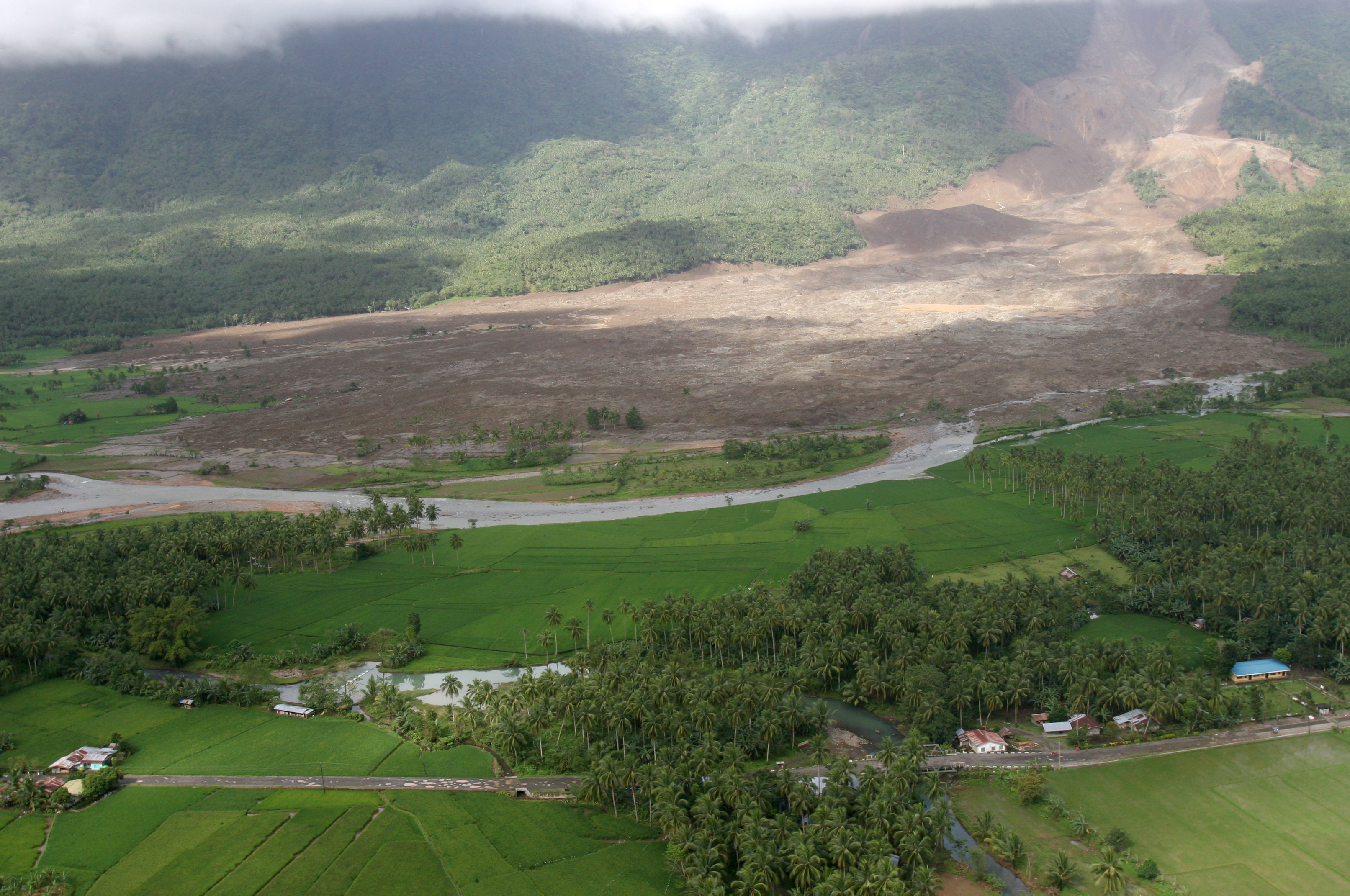
English: 060219-M-8084P-001 Saint Bernard, Republic of the Philippines (Feb. 19, 2006) - An aerial view of the mudslide, which destroyed the town of Guinsahugon the morning of Feb. 17. Guinsahugon is located in the southern part of the island of Leyte in the Philippines. The photo was taken from a CH-46E Sea Knight which was being flown to Guinsahugon to deliver relief supplies. The helicopter is from the 31st Marine Expeditionary Unit's aviation combat element Marine Medium Helicopter Squadron 262 (Reinforced). The MEU, based out of Okinawa, Japan, is deployed to the Philippines as part of the Forward Deployed Amphibious Ready Group (ARG) based out of Sasebo, Japan and was in the Philippines to take part in exercise Balikatan 2006 before responding to a request for aid by the Philippine government. U.S. Marine Corps photo by Lance Cpl. Raymond D. Petersen III (RELEASED)
Deutsch: Schlammlawine |
||||||
| Date | |||||||
| Source | http://www.navy.mil/view_image.asp?id=32089 | ||||||
| Author | Raymond D. Petersen III | ||||||
| Permission (Reusing this file) |
|
||||||




Historial de l'image
Puncha en la data/hora per a vore l'image tal i com es mostrava en eixe moment.
| Data/Hora | Miniatura | Dimensions | Usuari | Descripció | |
|---|---|---|---|---|---|
| actual | 12:42 20 feb 2006 | | 3225 × 2141 (4,61 MB) | wikimediacommons>Stefan Kühn | {{PD-USGov-Military-Navy}} Source: http://www.navy.mil/view_single.asp?id=32089 060219-M-8084P-001 Saint Bernard, Republic of the Philippines (Feb. 19, 2006) - An aerial view of the mudslide, which destroyed the town of Guinsahugon the morning of Feb. 1 |
Enllaços a l'image
Les següents pàgines enllacen ad esta image:
