
Archiu:Great Schism 1054 with former borders.png
Resolució completa. ((2000 × 2141 pixels, tamany de l'archiu: 420 kB, MIME tipo: image/png))

|
This religion map image could be re-created using vector graphics as an SVG file. This has several advantages; see Commons:Media for cleanup for more information. If an SVG form of this image is available, please upload it and afterwards replace this template with
{{vector version available|new image name}}.It is recommended to name the SVG file “Great Schism 1054 with former borders.svg”—then the template Vector version available (or Vva) does not need the new image name parameter. |
Summary
| Description |
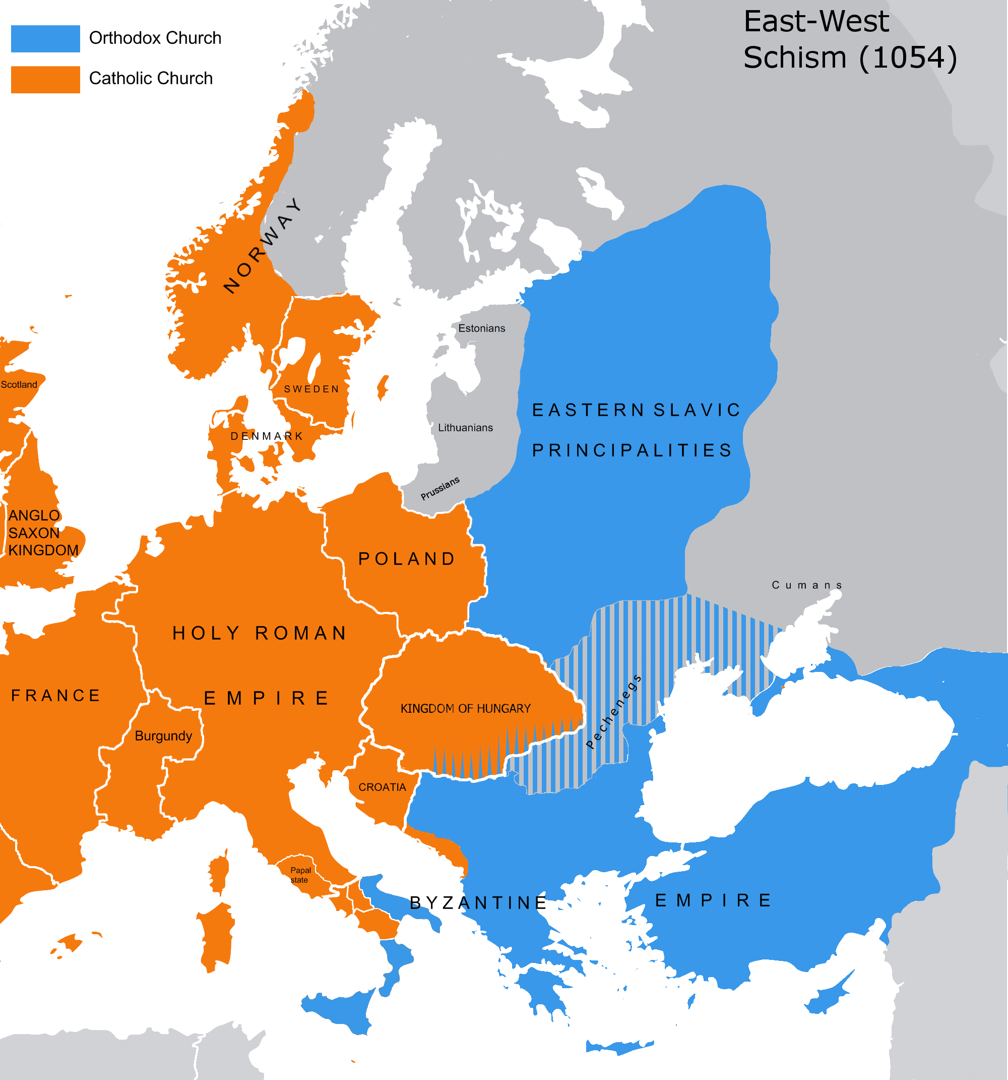
English: The map of the eastern/western allegiances in 1054 with the former country borders.
Español: El mapa de las creencias en el este/oeste en 1054 con las fronteras del país anterior. Los puntos representan concentraciones de minorías y no ubicaciones específicas. Las líneas rayadas representan cohabitaciones religiosas y no mayorías (que están representadas por colores sólidos).
Deutsch: Karte über das Morgenländische Schisma mit den ehemaligen Landesgrenzen. Die schraffierten Linien stellen religiöse Zusammenleben und keine Mehrheiten dar (die durch Vollfarben dargestellt werden).
Magyar: A nagy kelet-nyugati egyházszakadás térképe az 1054-nek megfelelő határokkal. A pontok a kisebbségek koncentrációját jelölik, nem pedig meghatározott helyeket. A sraffozott vonalak a vallási együttéléseket jelölik, nem pedig a többséget (amelyeket egyszínű színek jelölnek). |
||
| Date | 04.09.2010. | ||
| Source | Source: Westermanns Atlas zur Weltgeschichte, 1957, p. 64-5, maps titled "Staaten u. Bekenntnisse im Mittelmeerraum nach den ersten Kreuzzügen (um 1190)" (p. 64) and "Mittelmeerwelt und Vorderasien vor Beginn der Kreuzzüge (1096)" (p. 65) and Alexander Kazhdan (dir.), Oxford Dictionary of Byzantium, Oxford University Press, 1991, 1re éd., 3 tom. (ISBN 978-0-19-504652-6, LCCN 90023208), art. « Patriarchates », vol. 3, pp. 1599-1600. | ||
| Author | Tobi85 | ||
| Permission (Reusing this file) |
|
||
| Other versions | Derivative works of this file: Great Schism 1054 with former borders-ar.png |
Licensing
| I, the copyright holder of this work, release this work into the public domain. This applies worldwide. In some countries this may not be legally possible; if so: I grant anyone the right to use this work for any purpose, without any conditions, unless such conditions are required by law. |
_en.png)
.png)
.jpg)
Historial de l'image
Puncha en la data/hora per a vore l'image tal i com es mostrava en eixe moment.
| Data/Hora | Miniatura | Dimensions | Usuari | Descripció | |
|---|---|---|---|---|---|
| actual | 13:16 9 jul 2023 | Sense miniatura | 2000 × 2141 (420 kB) | wikimediacommons>Veverve | Reverted to version as of 21:25, 11 November 2022 (UTC): this is a huge extrapolation to make based solely on the fact that there were some Byzantine churches in Hungary |
Enllaços a l'image
Les següents pàgines enllacen ad esta image: